Overview of the flightlines
Simultaneously to ground measurements and SMOS overpasses, aircraft campaigns will be conducted over Kenaston and BERMS sites following the data acquisition calendar. Airborne microwave measurements will support the validation of SMOS products (L1, L2) and the pre-launch validation of SMAP data as well as the soil moisture retrievals from these two spatial missions. In addition to validation issues, the measurements will be used to:
- Investigate the scaling effect on remote sensing data over agricultural area.
- Develop and validate backscattering models over agricultural and forested areas from UAVSAR acquisitions.
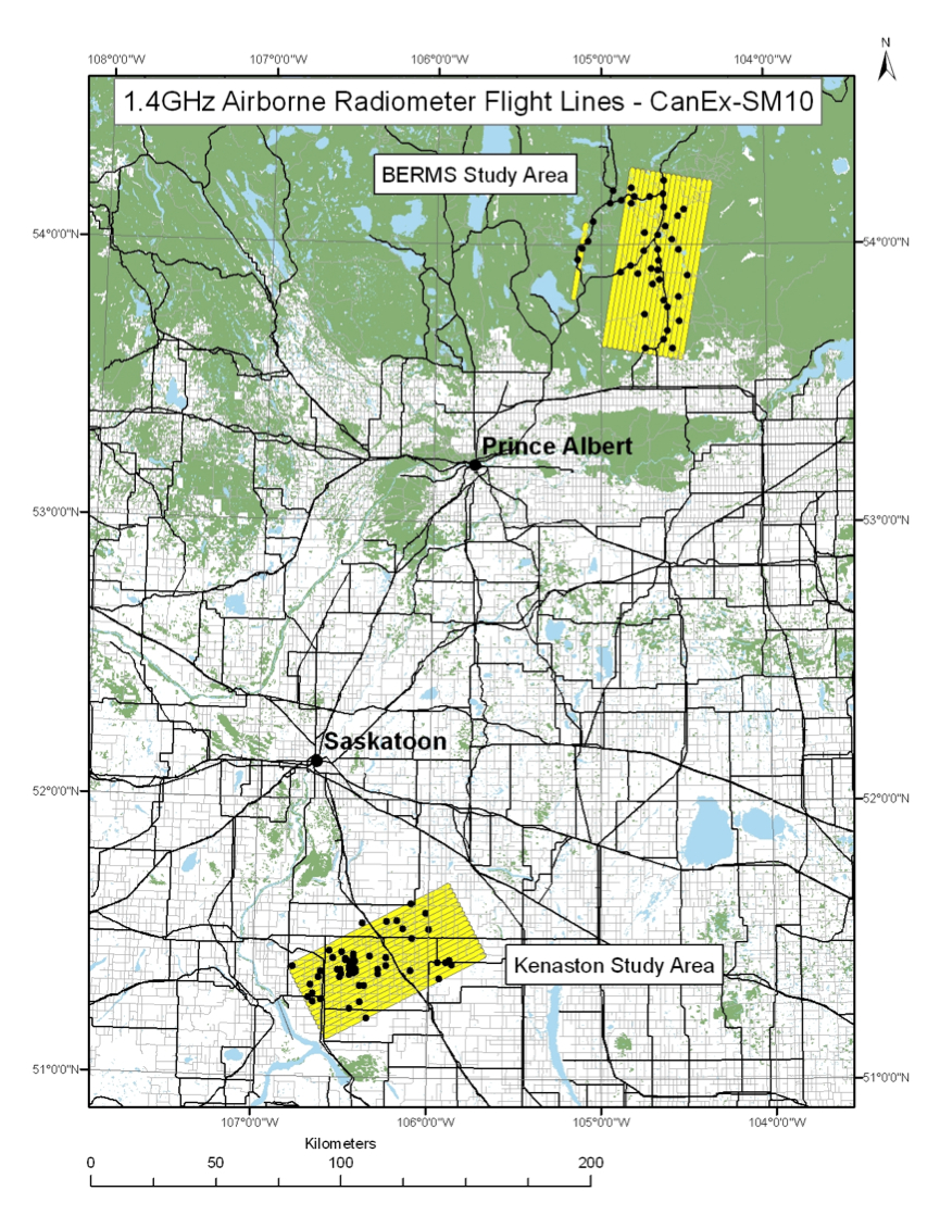
Twin Otter flight lines for both
Kenaston and
BERMS study areas. The dots represent the location of soil moisture measurement sites.