Kenaston: agricultural siteThe Kenaston site [51.14N–51.70N; 105.67W–106.79W] covers an area of 33 km x 71 km (about 2 SMOS pixels). The site benefits from two existing soil moisture measurement networks managed by Environment Canada and the University of Guelph. For a detailed description: click here. 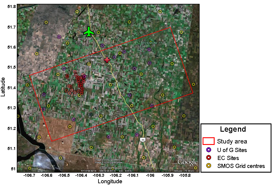 |
|
|
|
|
|
|
|
|