
Volumetric soil moisture
The second is a more intensive sampling to provide a sampling regime that would enable to relate the time series (networks) measurements to field averages. The intensive measurements will be also used to a) develop scaling method that would allow radar soil moisture retrievals to be related to SMOS data and to b) examine soil moisture variability within RADARSAT-2 standard mode spatial resolution. Strategy 1About 48-60 fields per day will be sampled for soil moisture measurements on June 2, 3, 5, 8, 10, and 13, 2010. At each field, data collection will be conducted along two transects distant of 400 m. Each transect will support seven measurement points at 100 m intervals. There will be 3 Hydra probe readings at 6 cm depth per measurement point. 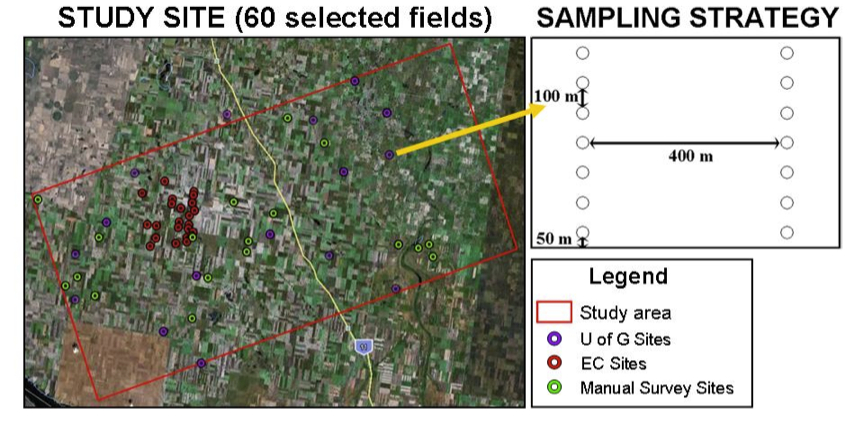
Diagram of the sampling strategy 1
Strategy 2Intensive soil moisture measurements will be conducted on June 7 and 11, 2010, in order to:
The sampling related to the time series data consists of soil moisture measurements along 4 transects distant of 200 m. Each transect will support 13 measurements points at 50 m intervals. There will be 3 Hydra probe readings at 6 cm depth per measurement point. 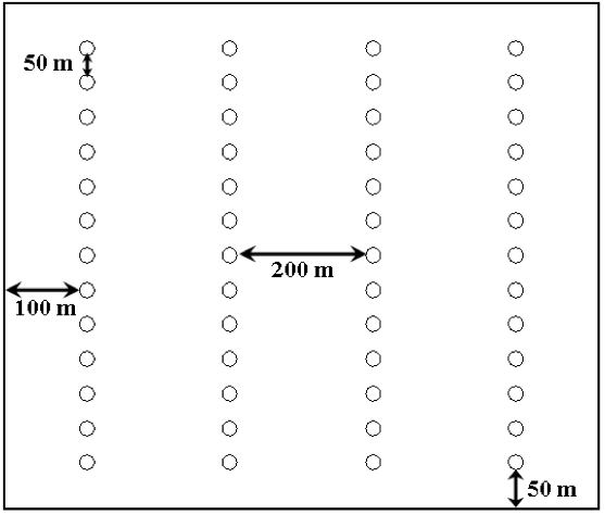
Diagram of the intensive sampling related to the time series data
The sampling related to the scaling of SMOS soil moisture data from radar soil moisture retrievals consists of soil moisture measurements along 5 transects distant of 50 m. Each transect will support 13 measurement points at 25 m intervals. There will be 3 Hydra probe readings at 6 cm depth per measurement point. 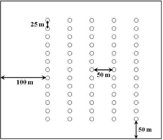
Diagram of the intensive sampling related to the scaling of SMOS soil moisture data from radar soil moisture retrievals
The sampling related to the soil moisture variability within RADARSAT-2 standard mode spatial resolution consists of soil mosture measurements along 6 transects distant of 10 m. Each transect will support 6 measurement points at 5 m intervals. There will be 3 Hydra probe readings at 6 cm depth per measurement point. 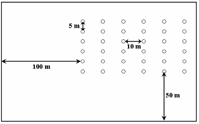
Diagram of the intensive sampling related to the soil moisture variability within RADARSAT-2 standard mode spatial resolution
Back |
|
|
|
|
|
|
|
|